


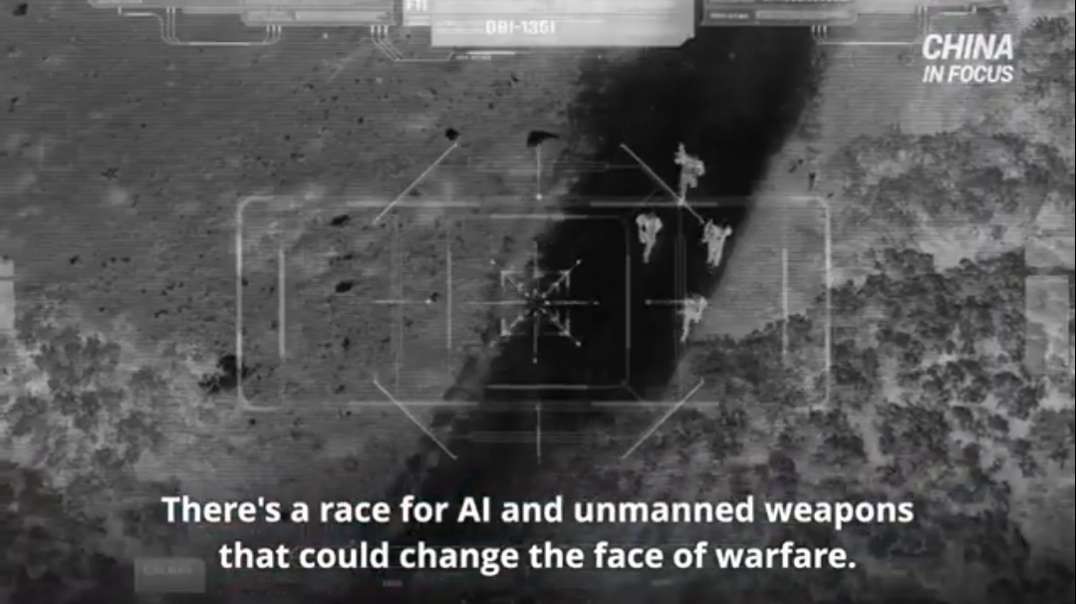


!~*ALERT*~! PRESIDENT TRUMP'S SPACE FORCE JUST SAVED AMERICA FROM INVASION!EVIDENCE NOW PILING UP(!)
DannyBoy7
1,362 vistas
!~*ALERT*~! PRESIDENT TRUMP'S SPACE FORCE JUST SAVED AMERICA FROM INVASION!EVIDENCE NOW PILING UP(!)
CR NEWS
1,745 vistas

Conscious Mind's
483 vistas

Rogue Banshee
491 vistas

Chris Wagoner
177 vistas
Rick Eutsler AirgunWeb / AirgunWebTV
397 vistas
Military Videos
531 vistas

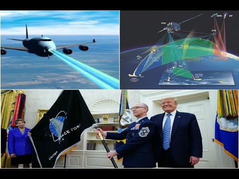
PRESIDENT TRUMP'S SPACE FORCE DEPLOYED *INFRARED LASER SATELLITE SWARM(!)NOW PROTECTING MAINLAND(!)

DannyBoy7 - 686 vistas
6
1
Publicado en 29 Dec 2020 / En Cine y Animación
Credit: Florida Marquis
Google Earth Pro 2020 Hi Res MAXAR Sateliite Imagery ! !
Brazil Pentagon ~ 2°17'38.74"S 44°25'26.79"W
Guadeloupe Pentagon ~ 16°20'36.01"N 61°29'12.52"W
McMinnville Crash ~ 35°39'45.18"N 85°51'3.70"W
Secret Drone Program ~ 36° 6'59.25"N 86°40'53.11"W
DownTown Event ~ 36° 9'52.70"N 86°46'36.78"W
Mostrar más

0 Comentarios
sort Ordenar por
!~*ALERT*~! PRESIDENT TRUMP'S SPACE FORCE JUST SAVED AMERICA FROM INVASION!EVIDENCE NOW PILING UP(!)
DannyBoy7
1,362 vistas
!~*ALERT*~! PRESIDENT TRUMP'S SPACE FORCE JUST SAVED AMERICA FROM INVASION!EVIDENCE NOW PILING UP(!)
CR NEWS
1,745 vistas
Conscious Mind's
483 vistas
Rogue Banshee
491 vistas
Chris Wagoner
177 vistas
Rick Eutsler AirgunWeb / AirgunWebTV
397 vistas
Military Videos
531 vistas